

SPECIAL CORRESPONDENT Katie Pesznecker took a road trip east from Portland, Oregon up the Columbia River Gorge. The Rose City is a popular destination for Alaskans. Maybe it’s time to make your own pilgrimage up the Gorge to hike the trails and see the waterfalls. —Scott
As a born-and-raised Oregonian who visits my home state whenever possible, the Columbia River Gorge is always on the itinerary. I especially love driving the Historic Columbia River Gorge Highway. In recent years, this trip turned tiresome as more people caught on to the Gorge’s charms. The “Old Highway,” as Oregonians call it, slowed and clogged with crawling traffic, awkwardly parked cars, throngs of bikers, hikers and more.
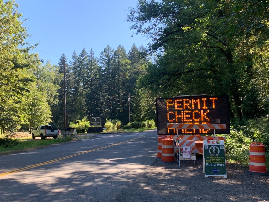
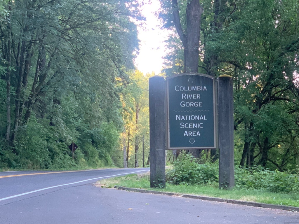
Attempting to balance preservation with people’s access to one of Oregon’s prettiest places, the State of Oregon recently enacted a timed use permitting system to drive a section of the Old Highway known as the waterfall corridor. The concept: between 9 a.m. and 6 p.m., you pay $2 per vehicle to enter the corridor from either the east or west during an hour-long slot of your choice. Once in, stay as long as you like. Alternately, you can come before or after the timed entry begins and ends each day, or wait it out: as of now, the permit system is in effect through September.
I was curious how this might play out, so I headed there with my mom during a recent Oregon visit to check it out. This lush corridor on Oregon’s northern border is a natural shrine showcasing Oregon at its very best. There are cascading waterfalls, dense forests bursting with ferns and wildflowers, and plenty of historical points of interest for photo ops, picnics, hiking and more.
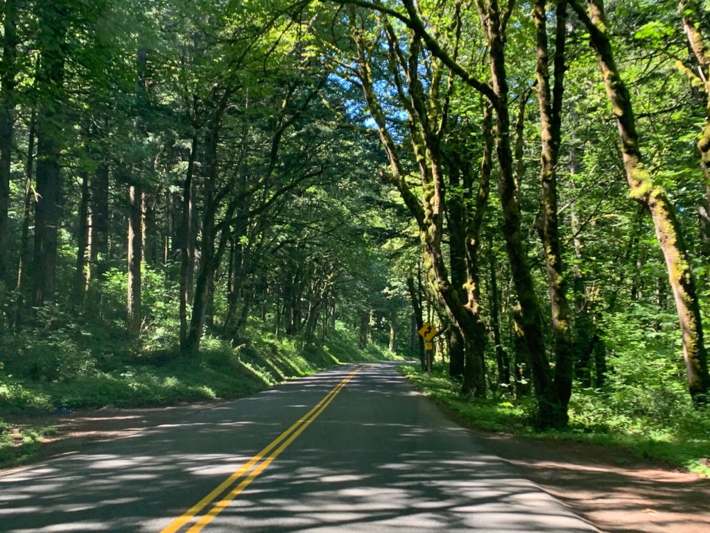
The best way to see the Gorge is via the Old Highway. Completed in 1918 in recognition of a growing need for road connecting Portland and The Dalles, the Historic Columbia River Highway is a civil engineering gem. With artistic stone masonry, epic spanning bridges, and sweeping roadways, its craftsmen envisioned and delivered a pleasure road that showcased the Gorge’s best spots and view points. In fact, one of the designer’s mothers famously told her son to avoid cutting down her precious Douglas Fir trees as much as possible.
The Old Highway was Oregon’s main east-to-west route for years. Over time, it became too narrow, too ambling, and sadly, too old. The new Interstate 84 slashed a straight and practical route along the Columbia River’s shore, plowing through low-elevation sections of the Old Highway that had to be razed. Other Old Highway features, like tunnels, were blasted away, deemed unsafe.
Today, you can drive two sections of the Old Highway. I’m less familiar with the 16-mile-long eastern section near The Dalles. My deep experience is entirely with the preserved 24-mile section that begins in Troutdale, just east of Portland.
I can’t quantify how many times I’ve been on this old road. Growing up, the Gorge was a special place for my family. Scores of camping trips took place here. Important milestones were marked with brunches at Multnomah Falls Lodge, or dinners at Tad’s Chicken and Dumplings. We honored sunny days with splashy hikes through creeks to waterfalls, and cones of soft-serve ice cream at the Eastwind Drive-in in Cascade Locks.
I especially loved the Old Highway itself, and its fascinating history. I worried the new timed permit system would make it harder than ever to visit. It turns out the opposite is true: the process was easy! After discussion, Mom jumped online a few days before our visit and secured us a 9-10 a.m. slot on a Friday.
You come upon the timed permit section of the Old Highway from either Bridal Veil Falls on the west end (which we did), or just east of Ainsworth State park on the east end. Check out a map here. You an also save some time by taking I-84 and taking Exit 28 for the Bridal Veil checkpoint or Exit 35 for Ainsworth.
If this sounds like a headache, or you can’t commit to an hour window, there are other Gorge attractions on the west (Troutdale) end of the Old Highway before you hit the corridor. Here’s how to do that:
Begin your journey on the Old Highway in the cute little town of Troutdale, in itself a fun stop with antique shops, cafes, and some fun beaches along the Sandy River. Traveling east, you’ll trail along the Sandy before the road winds gradually upward past farm acreage and through little towns.
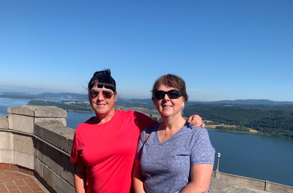
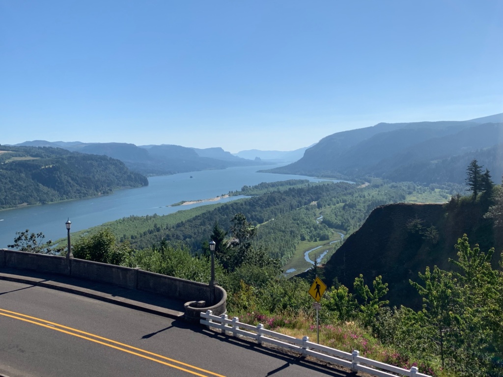
Soon you’ll reach Portland Women’s Forum State Scenic Viewpoint. This breathtaking vantage point is viewed by many as the gateway to the Gorge. With seemingly never-ending views of the serene Columbia and the Gorge’s lovely folds of basalt cliffs, you have an especially great shot of the nearest towering rock promontory which is topped by the historic Vista House.
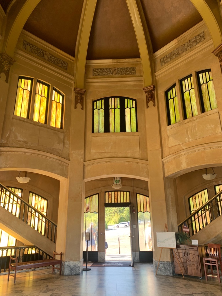
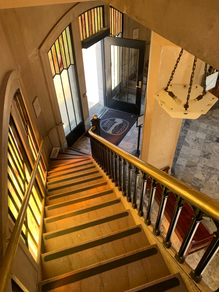
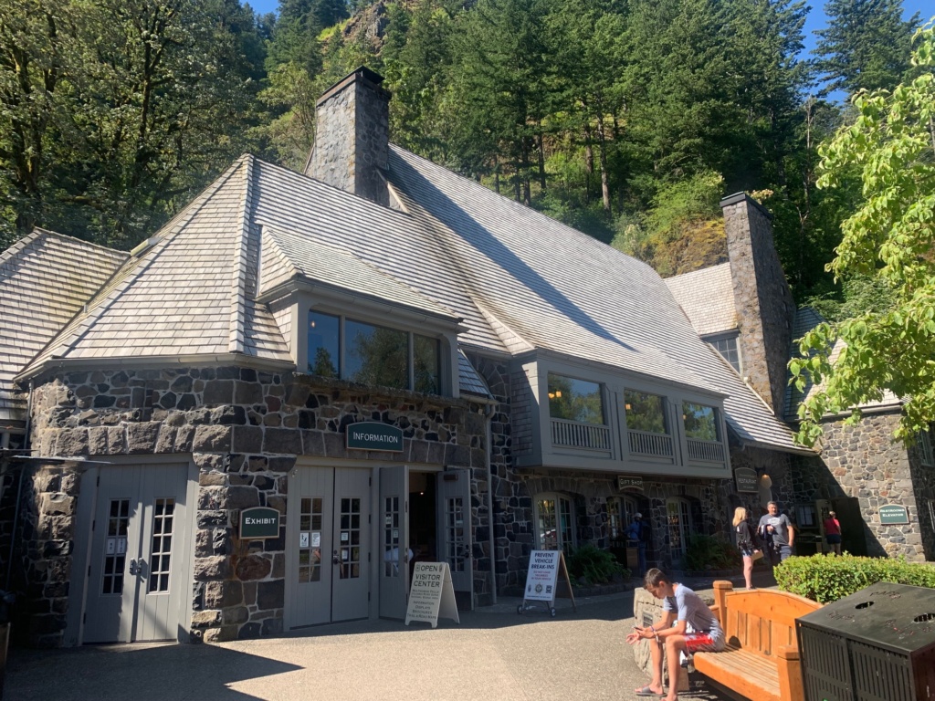
Continue a few minutes onward and check out the Vista House. Built in 1917, this is an example of German art nouveau architecture, a softly toned rotunda interior featuring marble, limestone, sandstone and bronze, topped with a dome. Elegant curving staircases access upper viewing decks. Outside, lamp posts encircle the property and glow at night, and from I-84 below it truly looks like a crown, and reinforce Crown Point’s name. Inside the Vista House are historical displays about Gorge history, a gift shop, a coffee shop, and more.
Leaving the Vista House, the road swoops and curves gracefully downward through the thick overhanging tress, arriving at blink-and-you’ll-miss-it Shepherd’s Dell. Park and walk the super-short stone trail down to this woodsy nook that contains cascading falls spilling from a wooded canyon, and a gorgeous view of the beautiful Old Highway bridge. This land was donated the City of Portland in 1915 by George Shepherd, a farmer who so reverently appreciated this natural alcove that he would hold Sunday worship here with his family on Sundays.
Finally, your last stop before hitting the highway paywall is the 249-foot Latourell Falls. This jaw-dropping ribbon of water plummets into a misty pond, back-dropped by toothy columnar basalt and neon shades of mossy lichen.
From that point on, it’s pay to play. You might think, “Why bother? That all sounds great!” And it is. But more awaits. Within the waterfall corridor are, in order: Bridal Veil Falls, Wahkeena Falls, Multnomah Falls, Multnomah Falls Lodge, Oneonta Gorge, and Horsetail Falls, a bunch of hiking trails that access even more waterfalls and sites, a handful of old historic homes, various pullouts with pretty viewpoints, and more. Here’s a little about each spot you’ll see from the Old Highway:
Bridal Veil Falls is visible via a short hike from the highway. This broad curtain waterfall was once the site of a lumber mill.
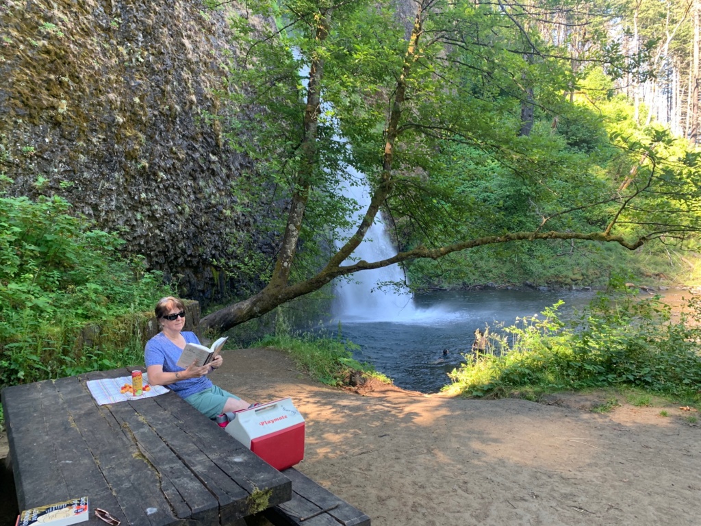
Wahkeena Falls is a twisty cascade that tumbles its way down a sloping rocky face. Down below the falls is a vast picnic area with lots of spots to hang out in the dappled sunshine as it filters through the trees. Wahkeena is a Yakima Indian word that means “most beautiful.”
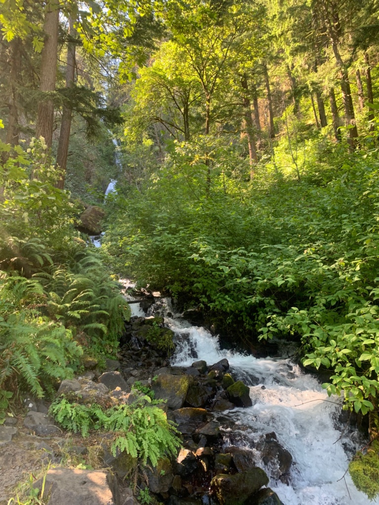
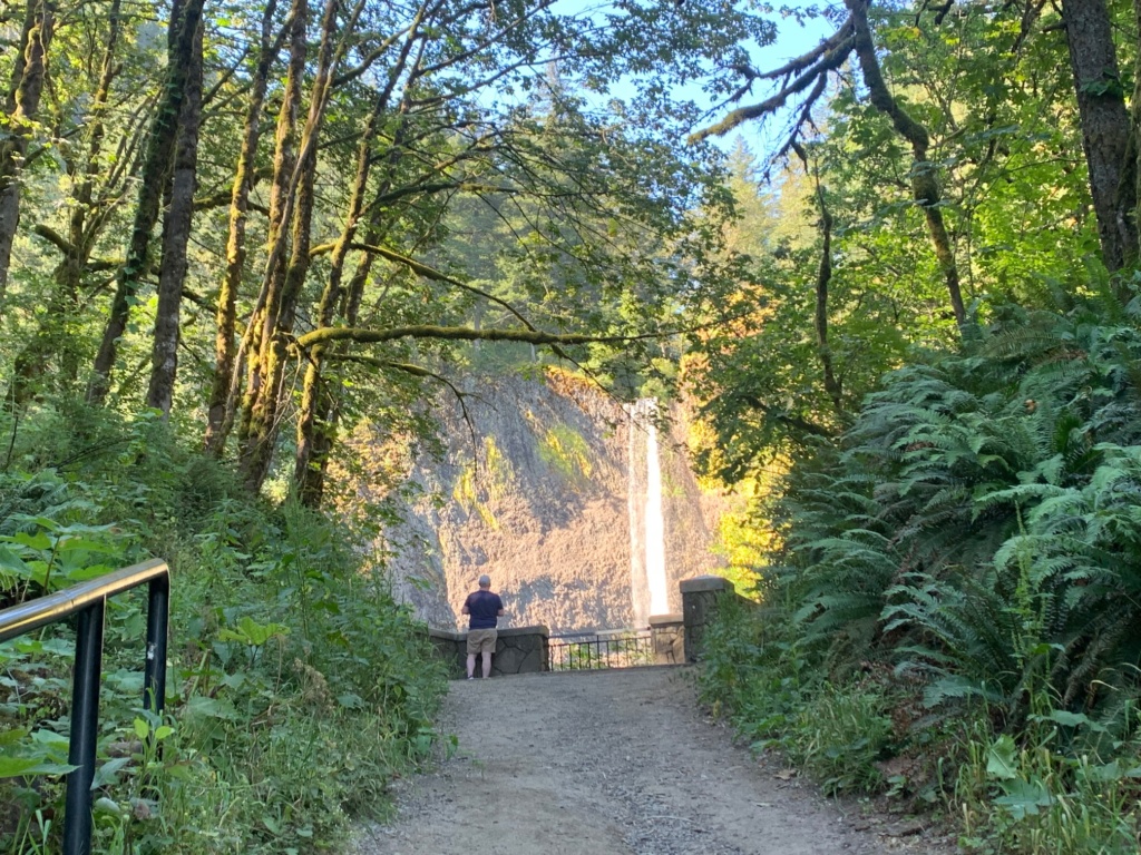
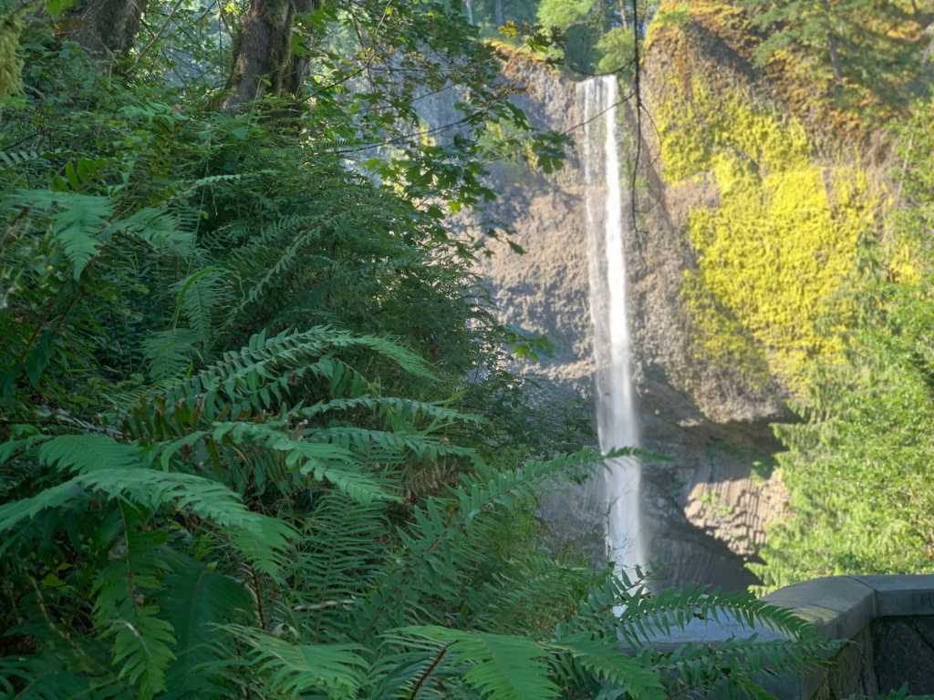
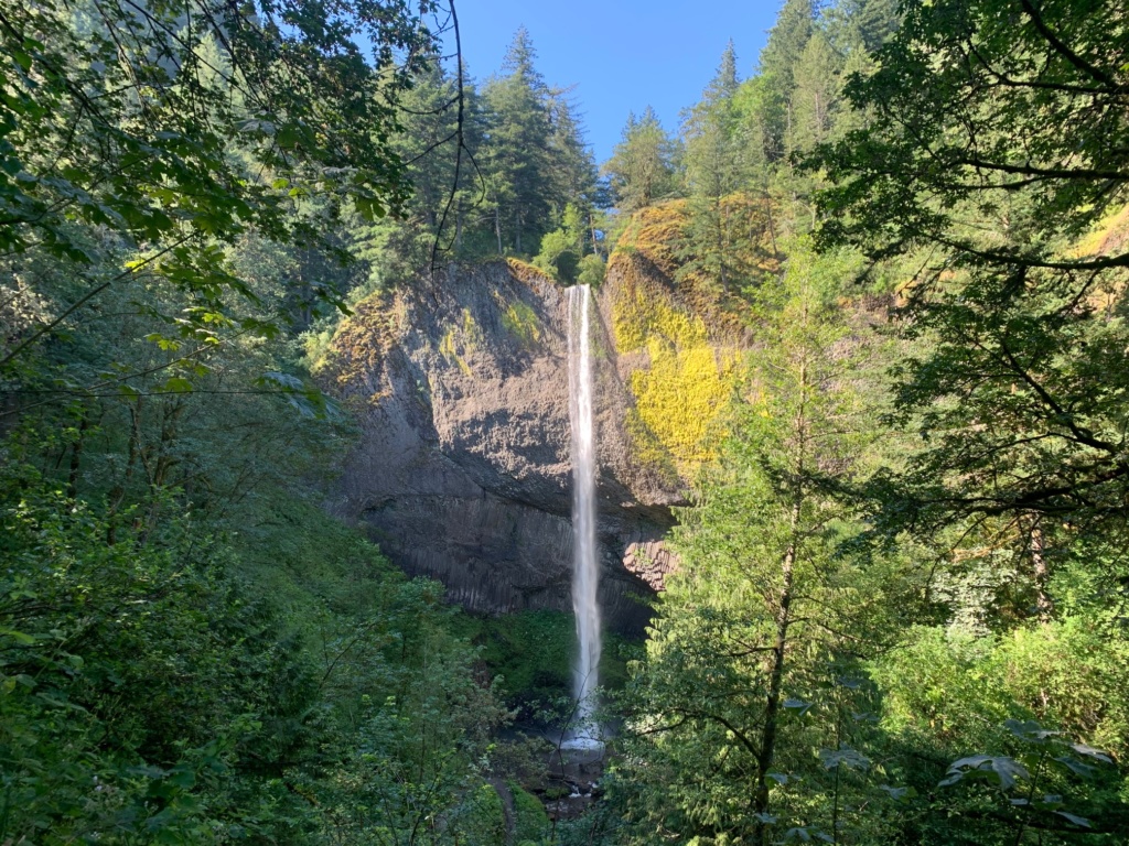
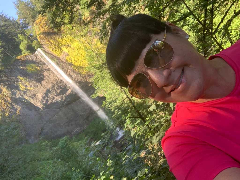
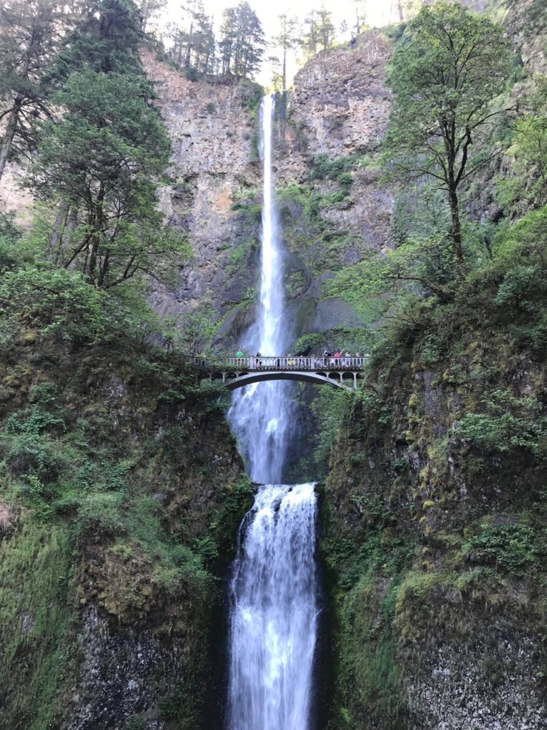
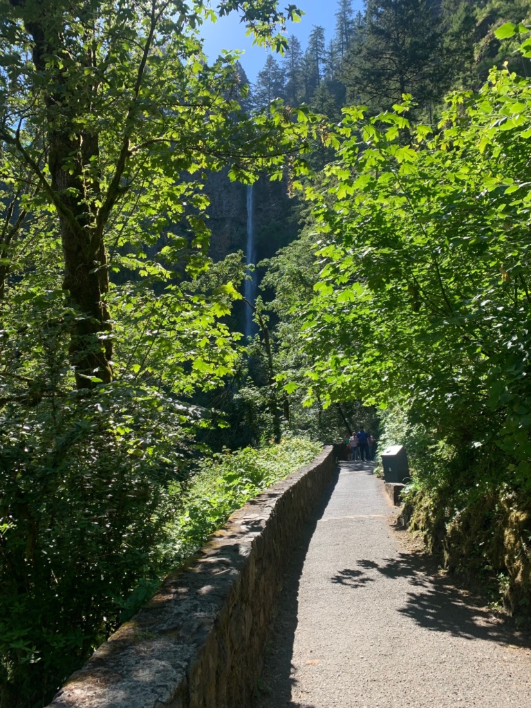
Multnomah Falls, Oregon’s top visitors attraction, is the only waterfall I mention in this piece that you can also get to by taking I-84; an exit delivers you to a parking lot, to a foot path and tunnel, and then to the falls complex. To access the falls this way, there is a separate permitting system; also, the parking lot often fills up, and the exit then closes. Your best bet is to get a timed use permit and take the Old Highway. In an orderly fashion (minded by a watchful attendant), you wait in line for a spot in the lot that’s available to Old Highway motorists. The 620-foot, two-tier falls are stunning. A quick hike will take you to the bridge and it’s worth it for the stunning view.
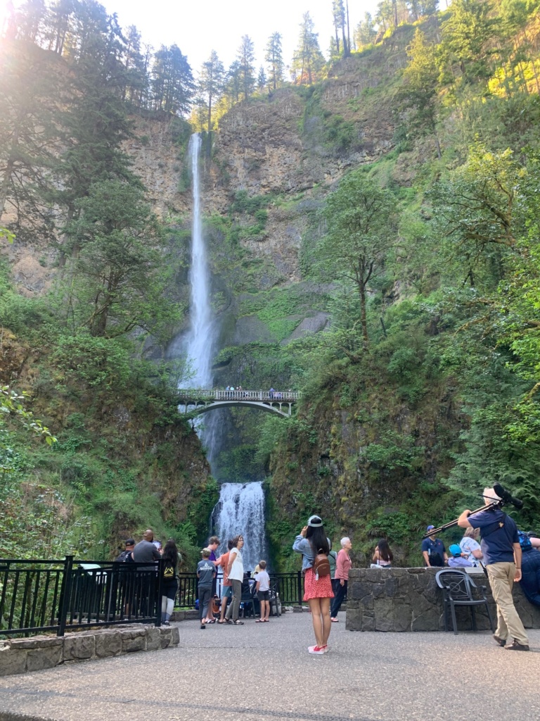
And don’t miss Mutnomah Falls Lodge. Its restaurant and bar embody rustic elegance. The dining room boasts incomparable views of the falls, with an impressive stone fireplace and gorgeous watercolor paintings of Gorge landmarks. There’s also a gift shop, snack bar, and an espresso stand with killer fudge.
- Oneonta Gorge is next. Pull over to appreciate the narrow chasm slicing through the rocks, and the timber-framed Oneonta Tunnel, once purposefully blocked back-filled by debris, and only in recent years restored and reborn.
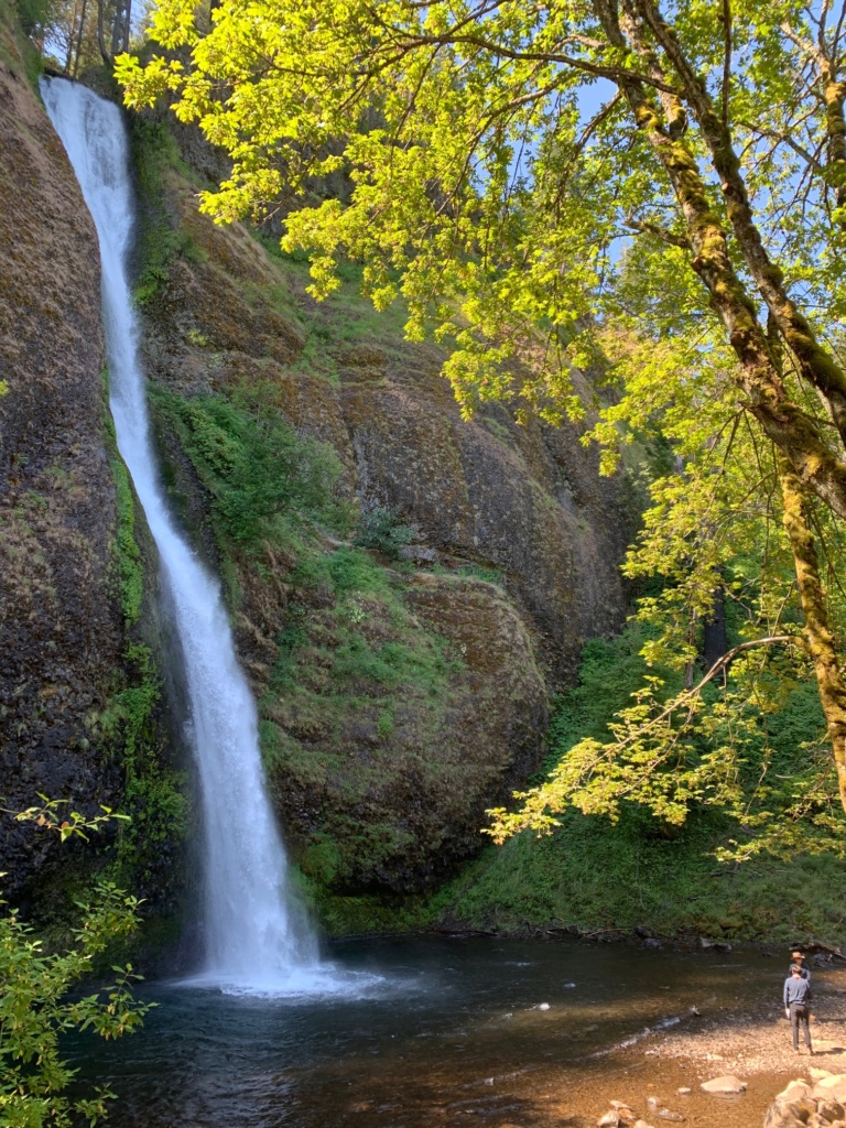
Your journey ends with Horsetail Falls. This waterfall splays and sprays from its cliff-top origin in a jaunty way that honors its name. On a hot day, it’s a common swimming hole.
Keep in mind, all these places have access to trails and hiking, or picnic tables, or historic plaques packed with info, or all of the above. So if you have a long layover in or visit to Portland, consider a Gorge trip, and consider giving this timed use system a try.
Not only was the process easy to navigate, but it was refreshing and soul-satisfying to visit the Gorge for the first time in years and not fight crowds or face frustrations of missing favorite spots due to having literally nowhere to park.
The Columbia River Gorge is a geological wonder, carved millennia ago when ice dams failed and unfathomable volumes of water roared toward the Pacific, chewing through the soft volcanic basalt and leaving a wondrous masterpiece in its wake. Since that violent and spectacular birth, this natural space has endured development, forest fires, political battles, crowds, and more.
Now, maybe we are entering a new era, where we can all enjoy it in a way that’s orderly, leisurely, and above all, respectful. Happy trails.
Note: Timed use permits went into effect in May 2022 and as of press time, are required through Sept. 25, 2022.
Share this Post
